setup | system description | photos | videos | geographical site | lidar data | articles | contacts
| Laser type | Nd:YAG, Continuum Powerlite 8010 |
| Wavelength (nm) | 355, 532 |
| Nominal energy per pulse (mJ) | ~400 (355 nm), ~200 (532 nm) |
| Pulse duration (ns) | 7 |
| Pulse repetition rate (Hz) | 10 |
| Beam radius (mm) | 45 (after 5 x beam expander) |
| Beam divergence (mrad) | 0.1 (nominal, full angle after beam expander) |
| Pointing stability (mrad) | ~0.05 |
| Collector 1 | Collector 2 | Collector 3 | |
|---|---|---|---|
| Type of telescope | 9 Newtonians array | Single Newtonian | Single Newtonian |
| Diameter (mm) | 500 (each) | 300 | 150 |
| Focal length f (mm) | 1500 | 900 | 450 |
| f-number | f/3 | f/3 | f/3 |
| FOV, full angle (mrad) | 0.5 | 0.9 | 1.8 |
| Collector 1 | Collector 2 | Collector 3 |
|---|---|---|
| Raman UT channels: 387 nm, 407 nm |
Raman LT channels: 387 nm, 407 nm |
|
| Elastic (T): 532 nm |
Elastic (UTLS): 532 nm |
Elastic (PBL, LT): 532 nm |
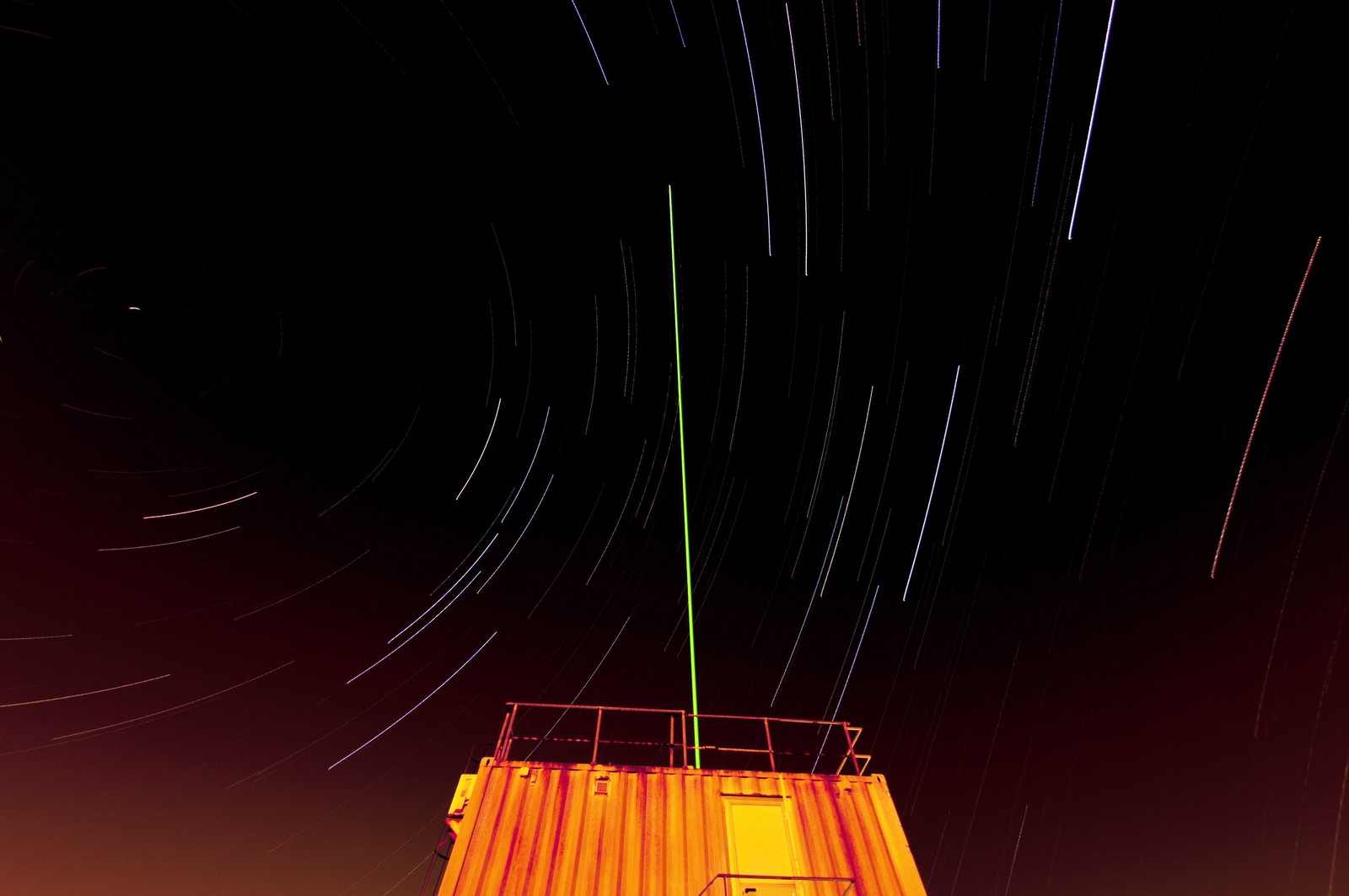
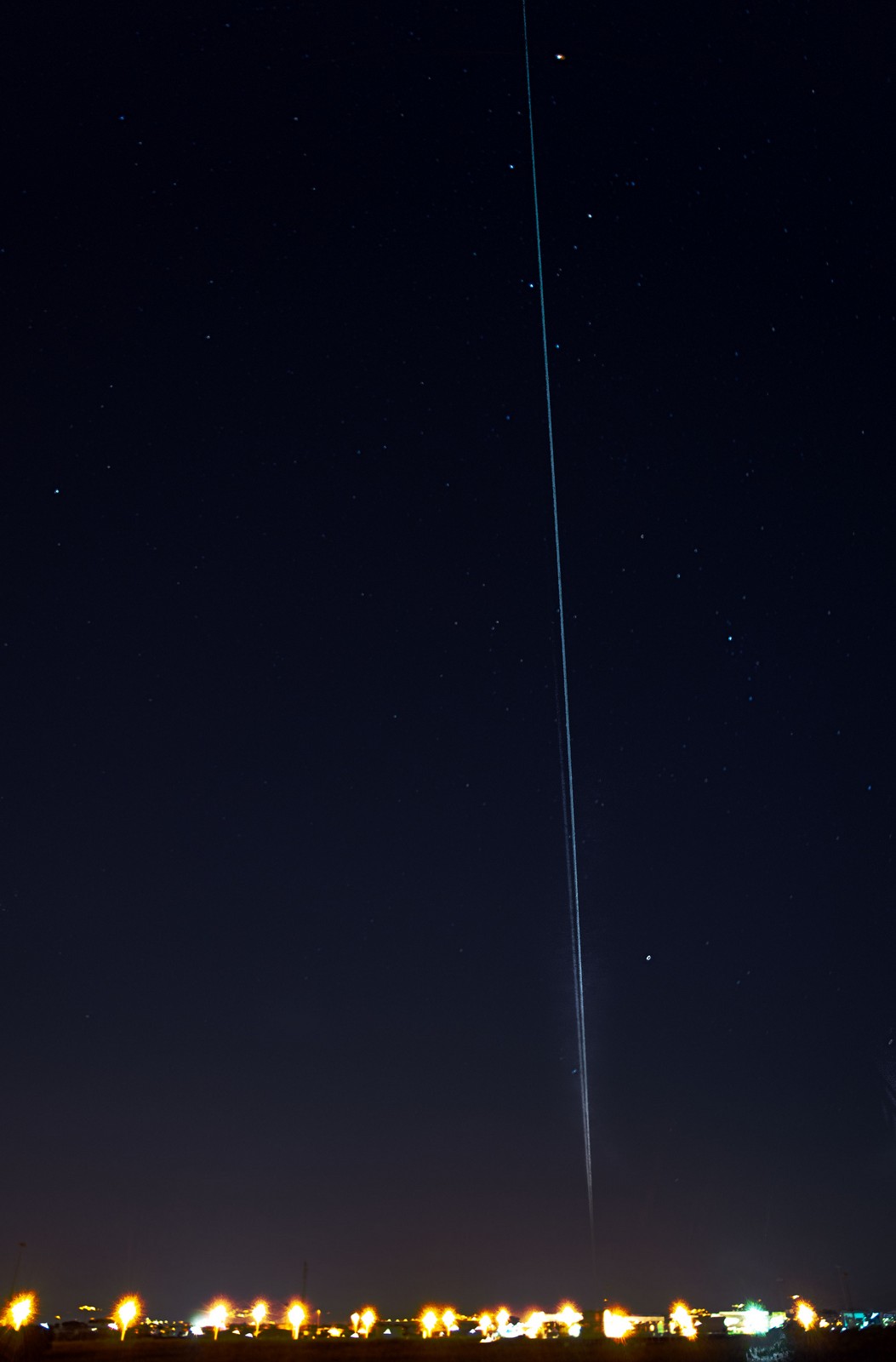
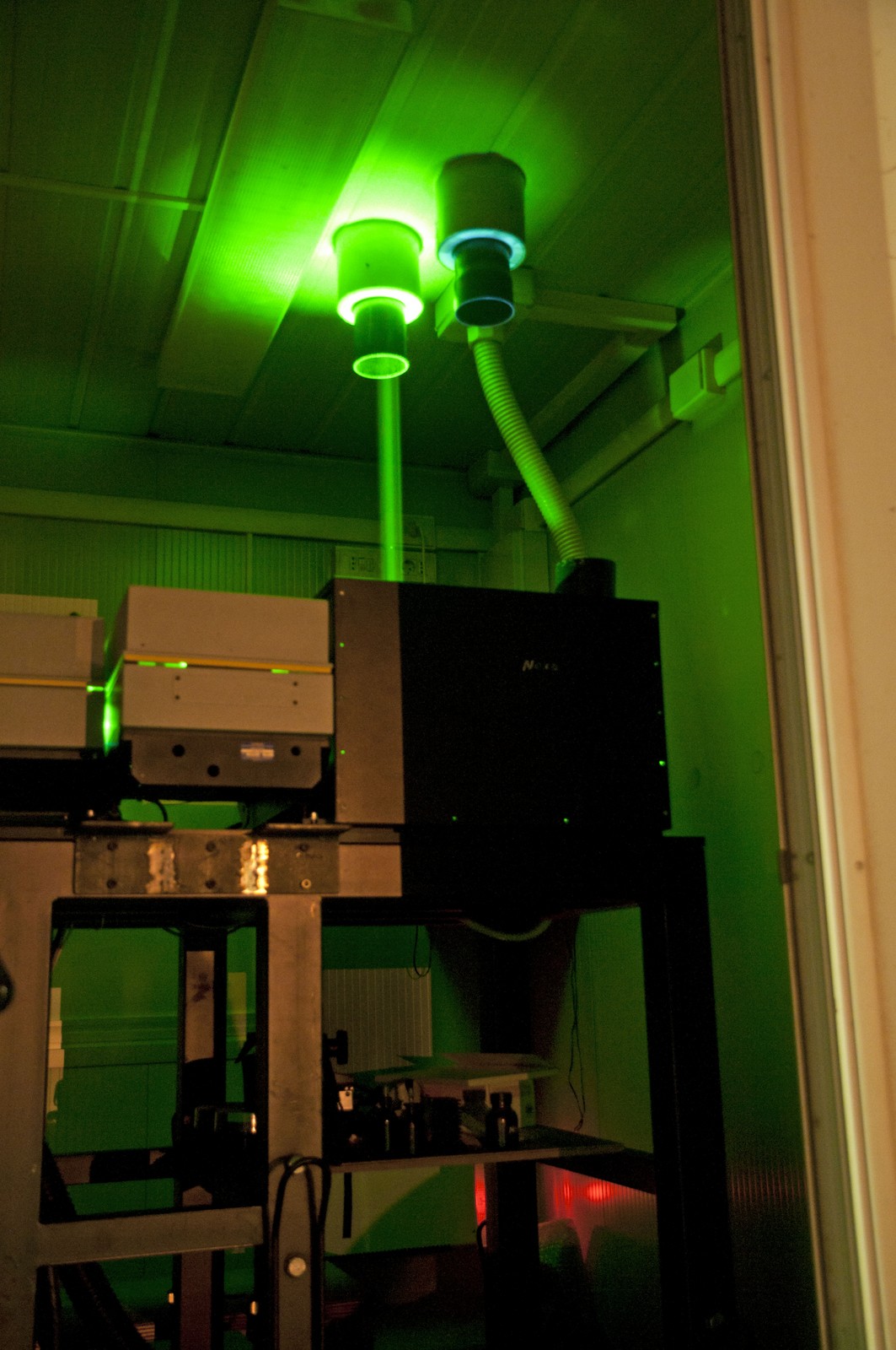
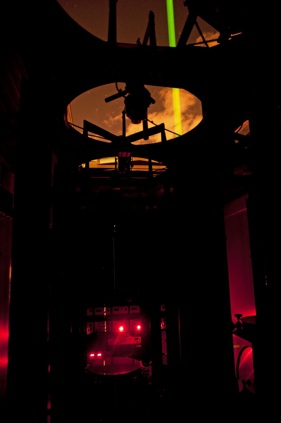
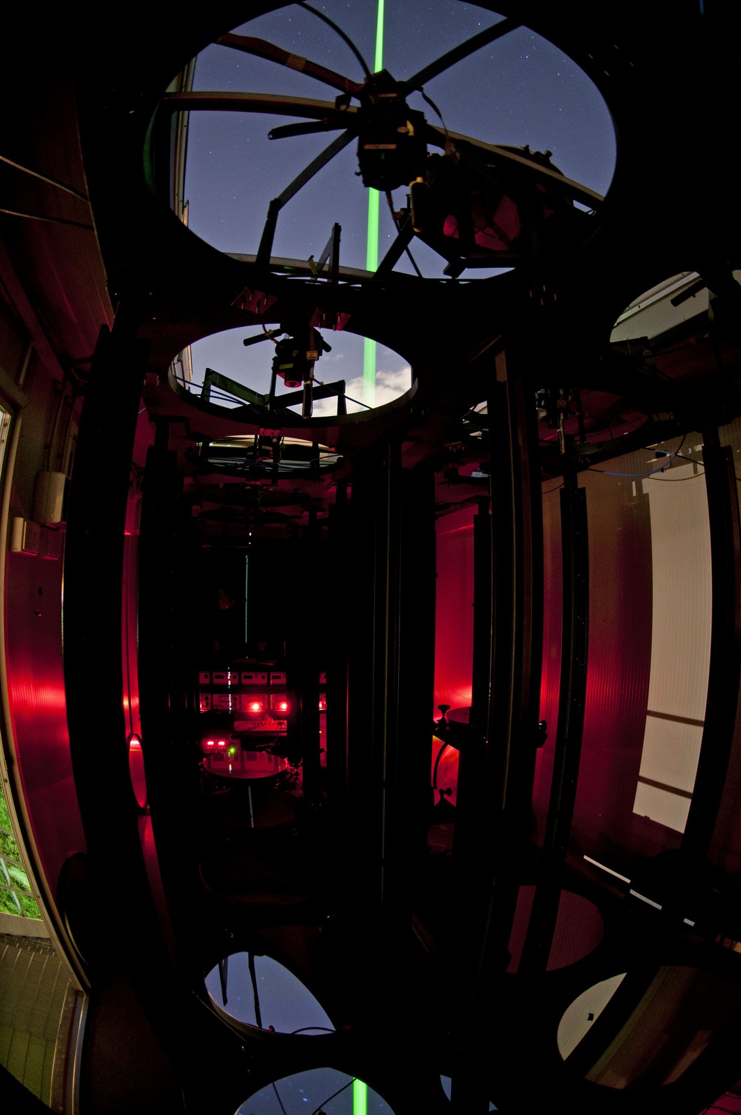
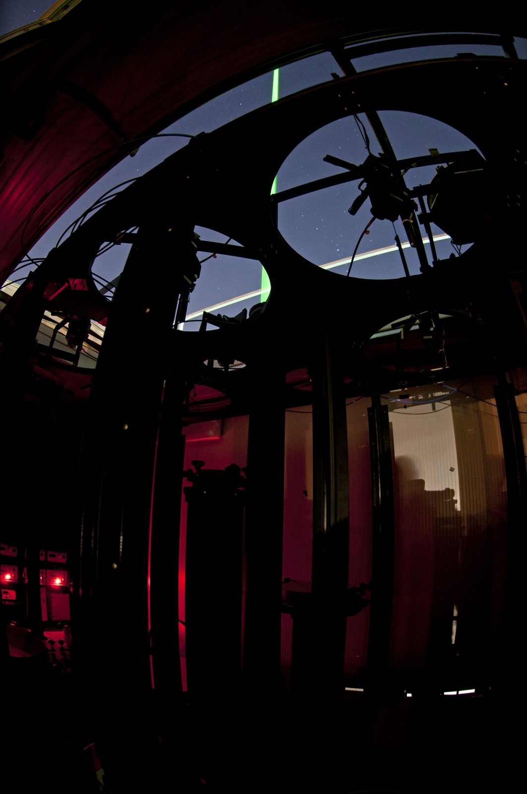
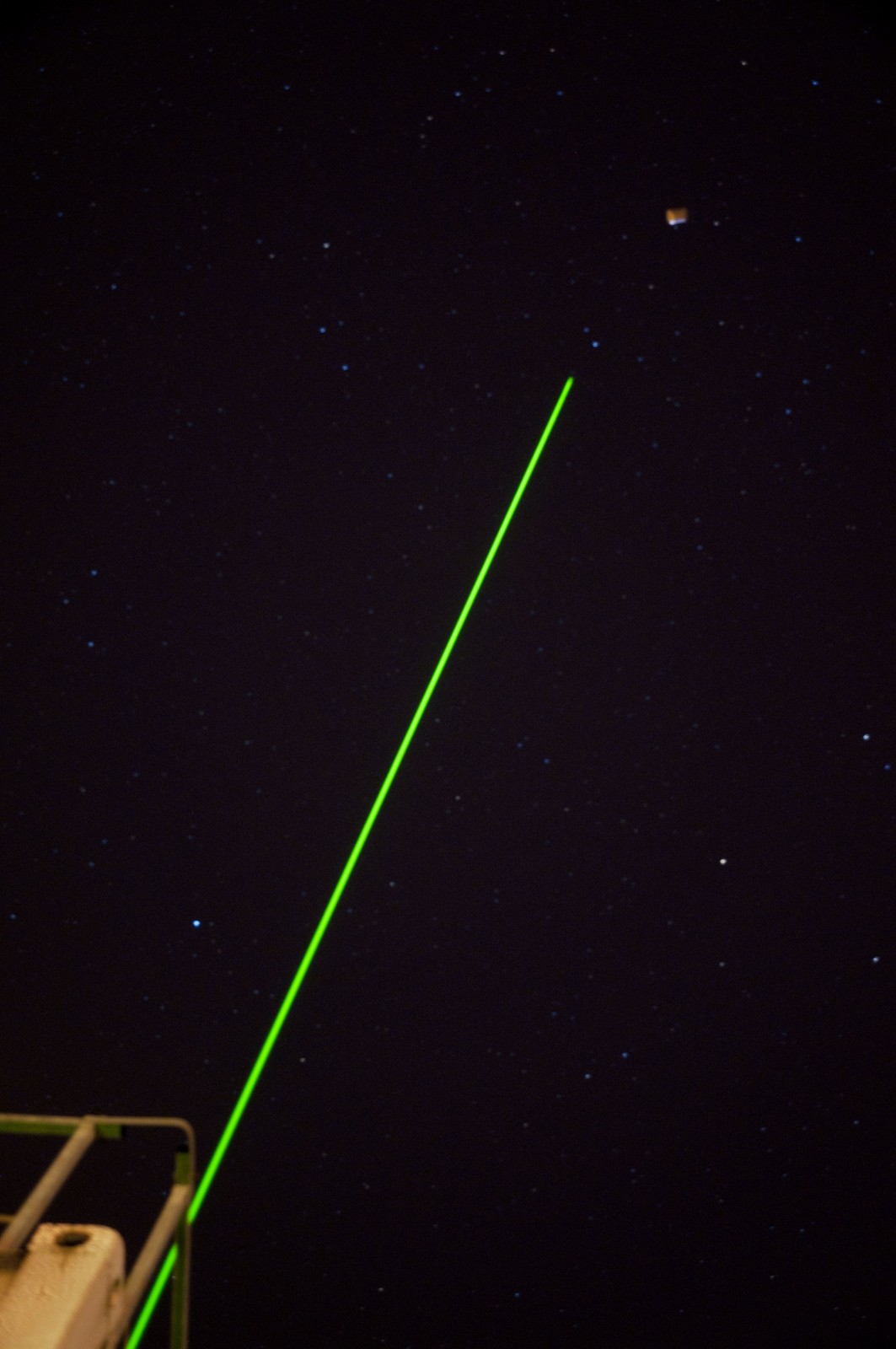
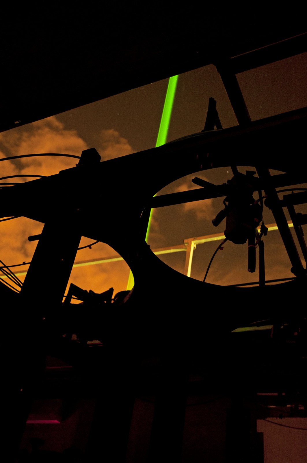
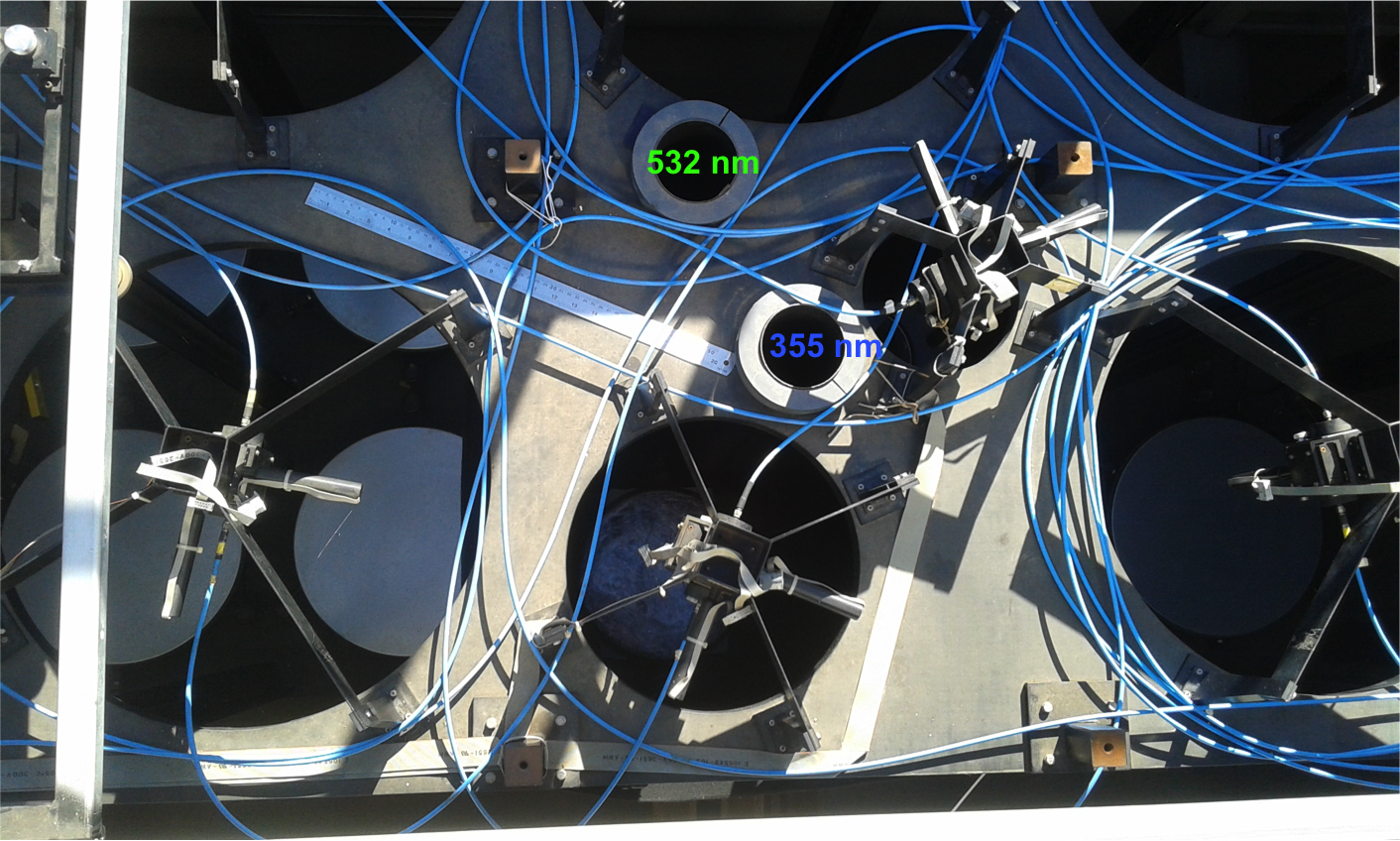
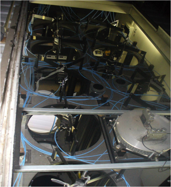
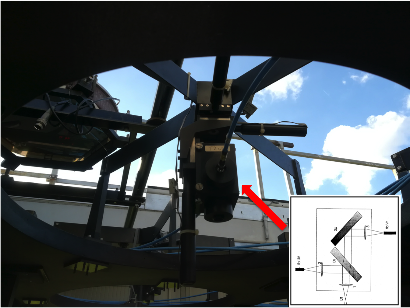
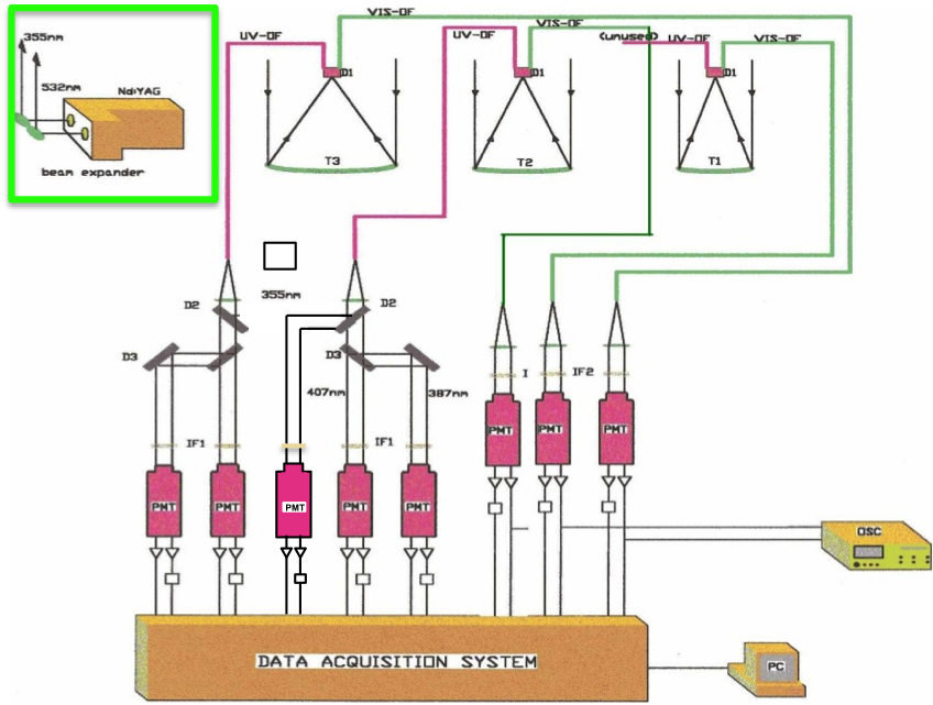
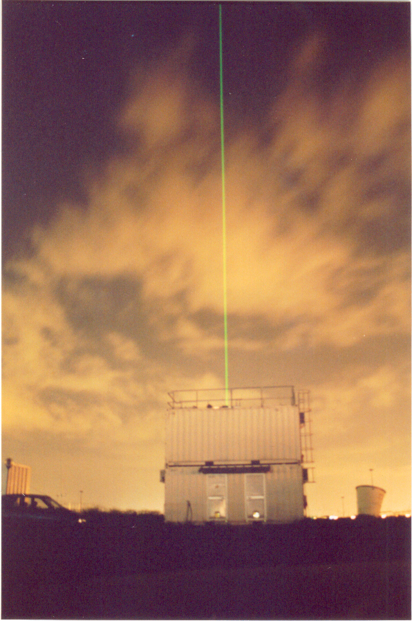
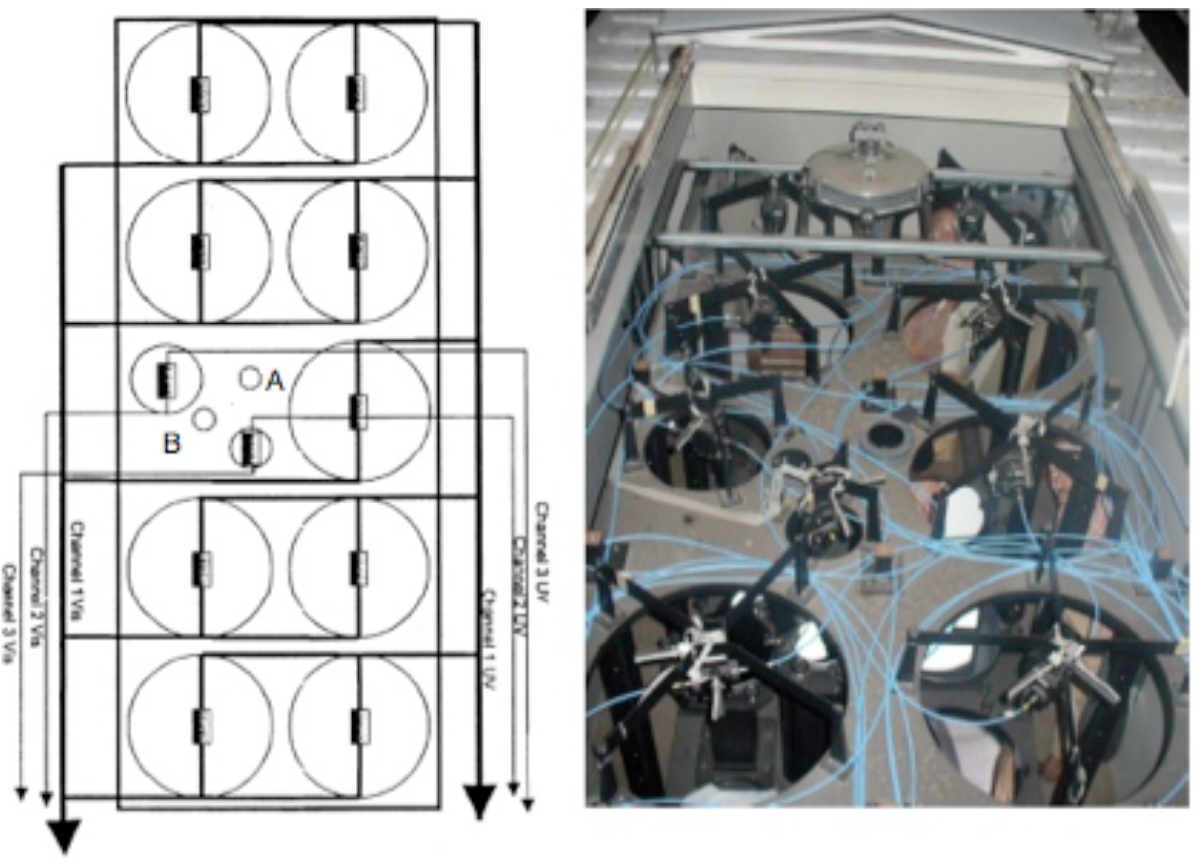
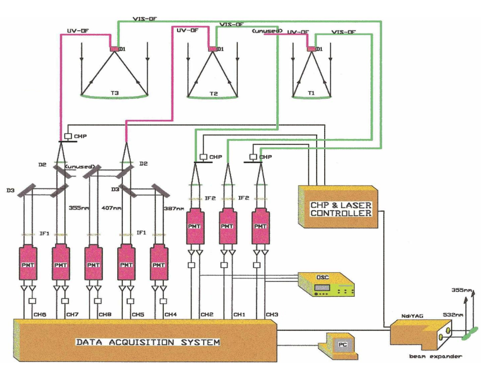
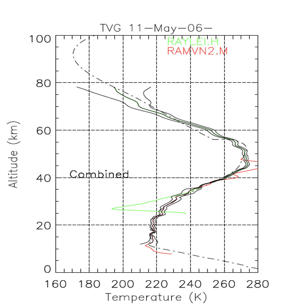
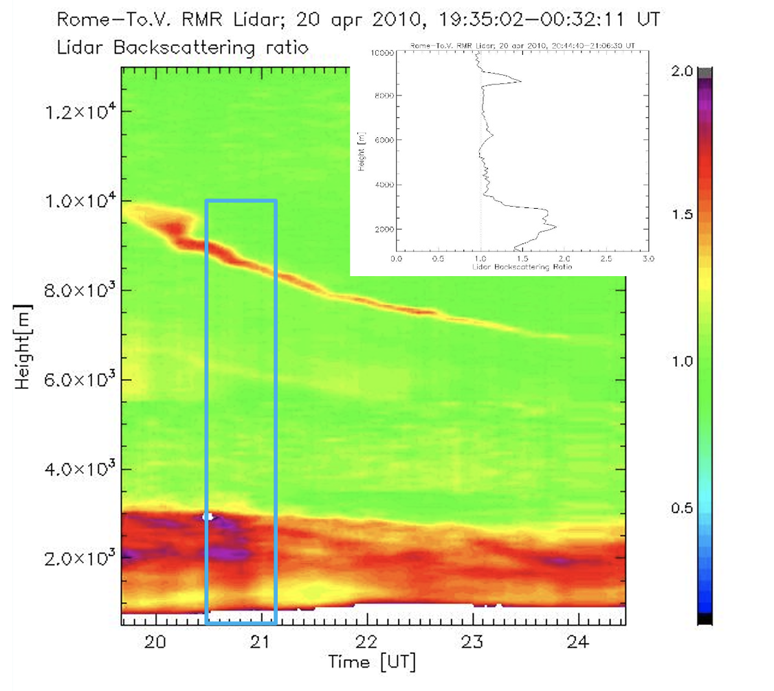
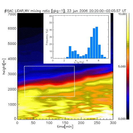
A multichannel RMR lidar system was designed and set up, and now is operative, in the Istituto di Scienze Marine – Consiglio Nazionale delle Ricerche (ISMAR-CNR) section of Rome-Tor Vergata. The system is assembled in two overlaying containers and can be utilized for routinely in situ observations or transported for measurement campaigns in remote sites. The Raman lidar is currently utilized to study the water vapor (WV) vertical distribution and its seasonal climatology. For this kind of nighttime measurements, the sounding ranges between the very first layers of the PBL up to close the tropopause. The acquisition resolution is 75 m in altitude and 1 min in time. For upper tropospheric information, software integration is recommended to improve the result quality, with a degraded resolution to 500 m in altitude and 10-20 min in time. In daytime measurement, the sounding range is reduced down to 3-5 km. The lidar can simultaneously supplies temperature profiles in the aerosol free atmosphere (upper stratosphere and mesosphere) through the Rayleigh lidar technique and aerosol profiles from the boundary layer up to the uppermost aerosols layers in stratosphere. Currently a regular protocol of data acquisition is applied producing a baseline set of observations sessions: at least one 4-5 hours session of measurement for each calendar week. Extra sessions are performed in case of occurrence of interesting cases. Processing of the data is performed according with special needs and available resources. The system uses two beams at 532 nm and 355 nm, second and third harmonics of a Nd:YAG laser. The green (532 nm) radiation is used to retrieve aerosol and temperature by using the elastic backscattering signal; the UV (355 nm) is used to produce and detect Raman-shifted backscattering signals, originated both by nitrogen (387 nm) and by water vapor (407 nm). Figure 1 shows the schematic of the multi-channel lidar receiver system, in which each channel having the proper sensitivity for sounding a different altitude sub-range. Figures 2 and 3 report examples of time patterns of the vertical profile of Lidar backscattering ratio, vertical profile of temperature and of processed time series of water vapor profiles.
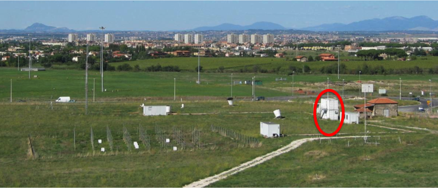
At present the Raman lidar system is installed in the Tor Vergata atmospheric observation field of the Institute. The observation field is at about 15 km SE from Rome in a rural environment where also different instruments are located (3 axes sodar, radiometers, AERONET sunphotometer, meteorological station, radar wind profiler, etc.) (Figure 4).
Hosting of instrumentation from external laboratories in the Tor Vergata observation field is possible through joint agreements and according with available resources needed for the correct instrument operation and maintenance.
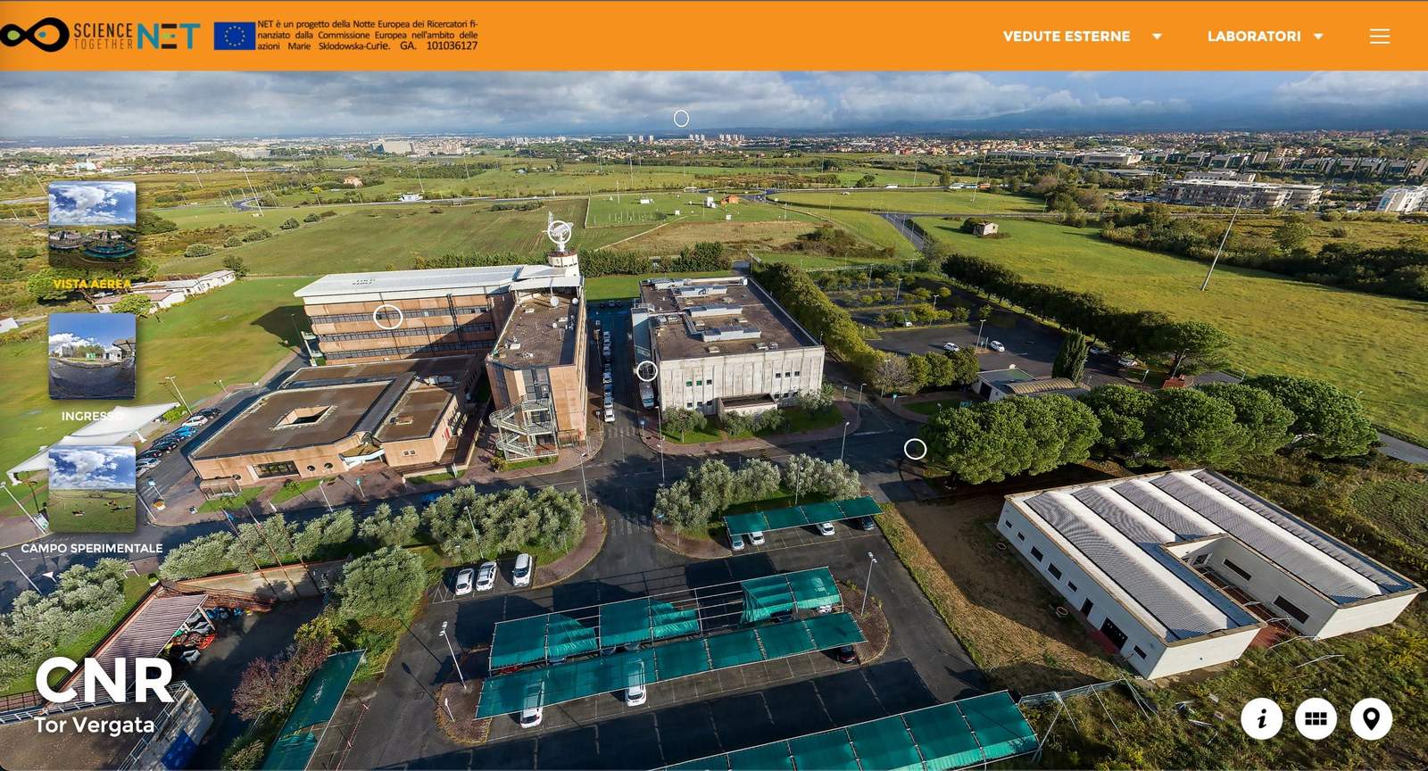
The RMR lidar is located in the "CAMPO SPERIMENTALE" area of the CNR-ARTOV. See virtual tour below.
In this section it is possible to visualize and download the results for every single year of measures of the processed time series of water vapor profiles in the form of quicklook images (jpg).
Recommended guidelines for data use and publication:
Although journal paper authorship and acknowledgement is the domain of the senior author and no policy is universally applicable, the RMR-lidar of CNR Rome - Tor Vergata contributors ask that every practical attempt be made to honor the following general guidelines.
Using RMR-lidar of CNR Rome - Tor Vergata data:
Please consult with the PI(s) and Co-I(s) of the data to be used.
Referencing:
Always cite the appropriate key RMR-lidar of CNR Rome - Tor Vergata papers for any publications as well as cite relevant manuscripts pertaining to previously published site data.
Publishing RMR data from a 'few' sites:
Please consider authorship for the PI(s) and Co-I(s) and/or the following acknowledgement:We thank the (Project/PI(s)/Co-I(s)) for (its/theirs) effort in establishing and maintaining (site name(s)) sites.
Publishing data from 'many' sites:
A general acknowledgement is typically sufficient and may read:We thank the (PI(s) and Co-I(s)) and their staff for establishing and maintaining the (#)sites used in this investigation. However if the RMR-lidar of CNR Rome - Tor Vergata data are a principal component of the paper then co-authorship to PI(s) and Co-I(s) should be offered.
A description of the data acquired from measurement sessions and a basic Fortran-like format to
read the single profile are given in the document provided here.